I have a new blog here, since I decided I'd like to leave this located in bolivia.
I miss all the friends and relationships made in Bolivia every day.
Cheers to everyone who reads this--send me an email or otherwise sometime, it's good to stay in touch.
erik
you can write me at radiophonicworkshop (the same prefix to this blogspot address) followed by @gmail.com.
Tuesday, March 4, 2008
Sunday, September 16, 2007
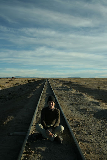
Summiting Longs Peak, Rocky Mountain National Park, CO, USA
The final event of our return trip was to attempt the summit of Longs Peak Rocky Mountain National Park--at 14,259 feet, it's the tallest mountain in the park. One can reach the summit entirely in one day, so long as one starts up the trail before 2am and is game for 16 hours of hiking/scrambling. We figured it would be more fun to hike to the boulderfield just below the more technical section and camp the night, allowing us to wake up around 7 to eat breakfast and start for the summit. On the way up, we took a 2 hour detour to Chasm Lake, situated below the face of the diamond (the shear east face of the mountain), on our way up--photo pending...
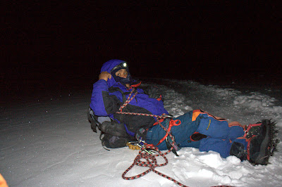
I don't seem to have a photo, but when we started this hike in the morning there had been a large storm that deposited snow across the peak and left a crampon-defeating film of verglas on the rocks which prevented ascents that day (the first snow of the year). Luckily it had, more or less, melted off by the evening--leaving occasional patches of refrozen ice and a good amount of drinking water right in the boulderfield. It was a bit chilly that night, but our tent held up well in winds that destroyed some less fortunate poles.
looking to the east of longs from the boulderfield
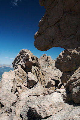
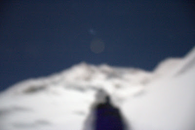
the peak itself--on the far right you can make out the keyhole
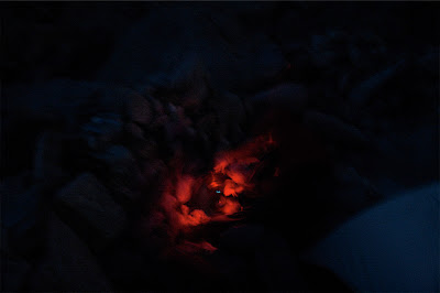
I've decided a headlamp isn't worth anything if it can't throw the majestic red light--boiling water for tea and sleeping the
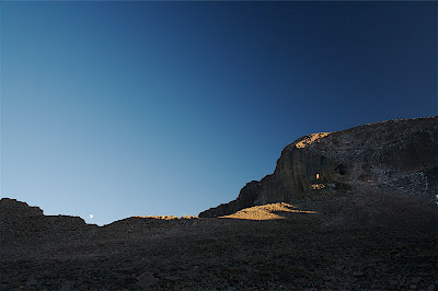
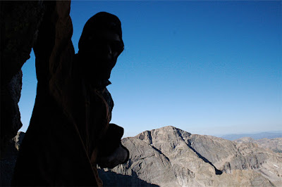
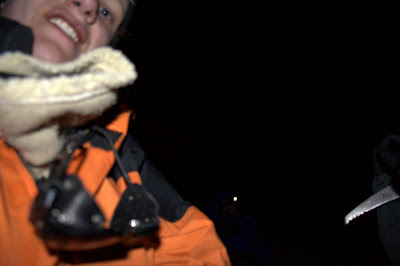
The first waypoint on summit day was pulling ourselves out of our wind battered tent into what we were told were 80mph winds--much worse than usual. Luckily we had balaclavas and hard shells to break the wind, but it would've been better to just have brought proper winter layers--such are the rockies. The first waypoint of the 'climb' was the keyhole, after which the class III route is named--we made our way up there after breakfast around 8 or 830.
Looking across the backside of the keyhole. Due to the structure of the rock, the winds here were quite violent. Only on the way back had they calmed enough such that I wasn't getting blown over and could pull my camera out for this picture.
Many people turned around here, because they just simply weren't prepared for the wind. Without a wind parka it would've been disconcertingly cold, and the nature of Longs is that many people go up unprepared. We pushed on into the wind, happy to have be with a smaller-than-usual number of people on the peak with us.
a view from behind the keyhole
another
The route continues through two long traverses and corresponding climbs that link one to the next and then the peak. They were a lot of fun, though very exposed with high winds. Definitely at the high of class III routes. I suppose that since this isn't so much intended to be a route description I won't get into too much detail--good ones exist on the internet and should be read instead if you have plans to attempt it. But, we took some great pictures...
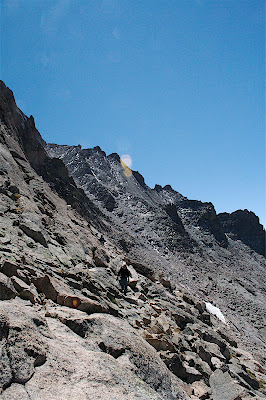
across the narrows toward the trough
exposed, but there were usually handholds when the route cornered and caught the heaviest winds
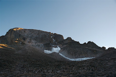
The homestretch, which is the final vertical part before the peak, runs up a smooth rock face with a crack in it. It was still pretty iced over in places. We took our time to move carefully up the crack and then finally topped out!
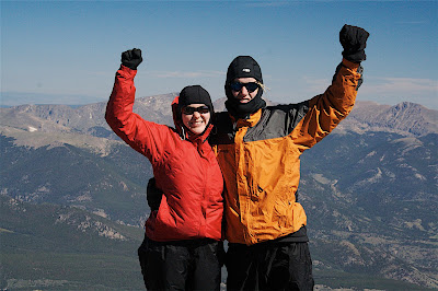
on the summit
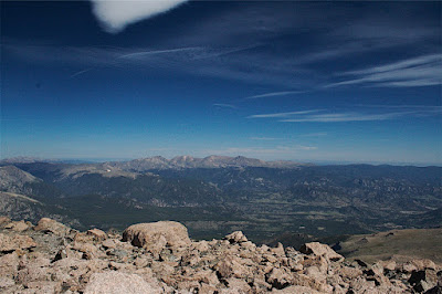
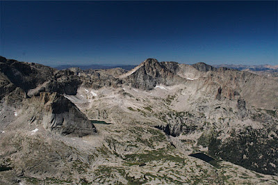
looking north across the park
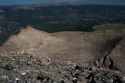
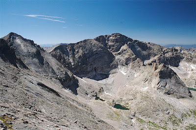
looking off the summit to the boulderfield, if you squint you might see a white pixel that is our tent
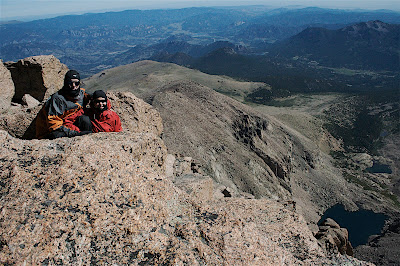
sitting together above the diamond on the east fast of Longs
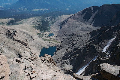
looking to the east down over the diamond onto chasm lake
This is a great peak. We made a good elevation gain (I think 6 or 7 thousand feet), which was really felt--even though Longs isn't as tall as most Bolivian peaks, I had become lost my acclimization in lower elevations since returning. It was a hard climb toward the end, but a great hike to share with Emily and a fine end to an amazing summer.
Somewhat sad not to have much more to post here for awhile. Plans are in the works for round two of travels--this time for an entire year after graduation. I also have a few short trips to various national parks lined up for during breaks from university that I'll write about here. Hopefully this isn't too melancholy of a hiatus.
I don't seem to have a photo, but when we started this hike in the morning there had been a large storm that deposited snow across the peak and left a crampon-defeating film of verglas on the rocks which prevented ascents that day (the first snow of the year). Luckily it had, more or less, melted off by the evening--leaving occasional patches of refrozen ice and a good amount of drinking water right in the boulderfield. It was a bit chilly that night, but our tent held up well in winds that destroyed some less fortunate poles.

looking to the east of longs from the boulderfield

the peak itself--on the far right you can make out the keyhole

I've decided a headlamp isn't worth anything if it can't throw the majestic red light--boiling water for tea and sleeping the
The first waypoint on summit day was pulling ourselves out of our wind battered tent into what we were told were 80mph winds--much worse than usual. Luckily we had balaclavas and hard shells to break the wind, but it would've been better to just have brought proper winter layers--such are the rockies. The first waypoint of the 'climb' was the keyhole, after which the class III route is named--we made our way up there after breakfast around 8 or 830.

Looking across the backside of the keyhole. Due to the structure of the rock, the winds here were quite violent. Only on the way back had they calmed enough such that I wasn't getting blown over and could pull my camera out for this picture.
Many people turned around here, because they just simply weren't prepared for the wind. Without a wind parka it would've been disconcertingly cold, and the nature of Longs is that many people go up unprepared. We pushed on into the wind, happy to have be with a smaller-than-usual number of people on the peak with us.

a view from behind the keyhole

another
The route continues through two long traverses and corresponding climbs that link one to the next and then the peak. They were a lot of fun, though very exposed with high winds. Definitely at the high of class III routes. I suppose that since this isn't so much intended to be a route description I won't get into too much detail--good ones exist on the internet and should be read instead if you have plans to attempt it. But, we took some great pictures...

across the narrows toward the trough

exposed, but there were usually handholds when the route cornered and caught the heaviest winds
The homestretch, which is the final vertical part before the peak, runs up a smooth rock face with a crack in it. It was still pretty iced over in places. We took our time to move carefully up the crack and then finally topped out!

on the summit

looking north across the park

looking off the summit to the boulderfield, if you squint you might see a white pixel that is our tent

sitting together above the diamond on the east fast of Longs

looking to the east down over the diamond onto chasm lake
This is a great peak. We made a good elevation gain (I think 6 or 7 thousand feet), which was really felt--even though Longs isn't as tall as most Bolivian peaks, I had become lost my acclimization in lower elevations since returning. It was a hard climb toward the end, but a great hike to share with Emily and a fine end to an amazing summer.
Somewhat sad not to have much more to post here for awhile. Plans are in the works for round two of travels--this time for an entire year after graduation. I also have a few short trips to various national parks lined up for during breaks from university that I'll write about here. Hopefully this isn't too melancholy of a hiatus.
Thursday, September 6, 2007
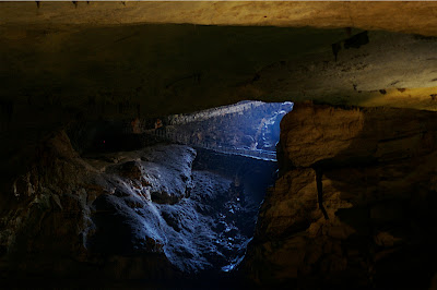
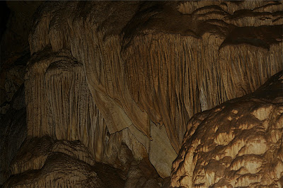
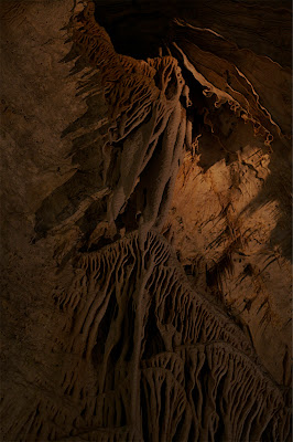
Carlsbad Caverns National Park, NM, USA
After finishing our time with NMD, and loading emily's things into her car, we took the long way home. Our first stop was Carlsbad Caverns NP, about 4 hours east of El Paso, TX. The Carlsbad cave network is one of the largest and the system is probably most famous for its immense chambers--the largest houses a 1.5 mile loop trail around its periphery. The neat thing about the cave is that one can enter via the first discovered natural entrance and wind down into its cool interior (about 60 degrees F) from the hot Chihuahuan desert above.
looking back toward the natural entrance
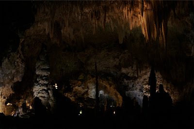
I imagine the best way to describe the features of the cave is via pictures, so here goes. These are all from our walk into the cave and explorations of the big room.
the plankton filtering teeth of "the whales head"
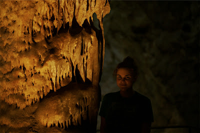
emily and an unnamed feature
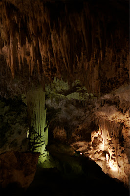
looking out into a part of one of the larger chambers--I should note that all these shots were taken on my 50mm prime lens since it is my fastest, but as such I was unable to get really wide angle shots of the interior. The place was enormous.
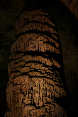
this tower was more than 2 meters in diameter and spanned from the floor to ceiling--maybe 15 meters in height
taken from across the big room, shows a bit of the size--the ceiling here was at least 100 feet high
neat curtains on the ceiling
We also took a ranger led tour into the "lower room," which is only accessible via a series of ropes and ladders (not chutes). It was alot of fun, but the ranger told us leaving cameras behind was a good idea given the squeezes we would be going through. I've taken my camera to some risky places, so I'm not sure why I didn't just bring it regardless. Unfortunately, I don't have any pictures to show from this helmet/headlamp expedition into less-explored realms of the cave. We escaped the crowds with our smaller group and had fun caving.
That night we hiked into the backcountry of the park (permits were free--the right price) and camped in the desert. The heat was quite a contrast.
The next day we would drive to Roswell, NM such that we might tour the international UFO museum there (their webpage, you should go) and then pass for Albequerque. There I got to met Emily's good friend Judy and her husband Keith, with whom we had dinner and spent the night (they were great).

looking back toward the natural entrance
I imagine the best way to describe the features of the cave is via pictures, so here goes. These are all from our walk into the cave and explorations of the big room.

the plankton filtering teeth of "the whales head"

emily and an unnamed feature

looking out into a part of one of the larger chambers--I should note that all these shots were taken on my 50mm prime lens since it is my fastest, but as such I was unable to get really wide angle shots of the interior. The place was enormous.

this tower was more than 2 meters in diameter and spanned from the floor to ceiling--maybe 15 meters in height

taken from across the big room, shows a bit of the size--the ceiling here was at least 100 feet high

neat curtains on the ceiling
We also took a ranger led tour into the "lower room," which is only accessible via a series of ropes and ladders (not chutes). It was alot of fun, but the ranger told us leaving cameras behind was a good idea given the squeezes we would be going through. I've taken my camera to some risky places, so I'm not sure why I didn't just bring it regardless. Unfortunately, I don't have any pictures to show from this helmet/headlamp expedition into less-explored realms of the cave. We escaped the crowds with our smaller group and had fun caving.
That night we hiked into the backcountry of the park (permits were free--the right price) and camped in the desert. The heat was quite a contrast.
The next day we would drive to Roswell, NM such that we might tour the international UFO museum there (their webpage, you should go) and then pass for Albequerque. There I got to met Emily's good friend Judy and her husband Keith, with whom we had dinner and spent the night (they were great).
Saturday, August 18, 2007
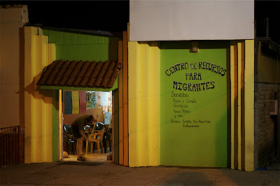
No Mas Muertes; Douglas/Agua Prieta; Arizona, USA/Sonora, Mexico
This will be the first of a series of three entries that will effectively catch everyone up on what I've been doing for the past month--namely, from my arrival in El Paso, TX to my return home to Omaha, NE for study . Sorry to have been delinquent during the interim, but life can be busy. Without further adieu.
Emily and I spent a week volunteering with No More Deaths along the US-Mexican border. No More Deaths was founded in response to the humanitarian disaster that occurs year-round in the Sonoran desert--hundreds of migrants die yearly. They run several operations in the area, ranging from a camp in the Sonoran desert that makes water drops and gives medical assistance to migrants to humanitarian aid shelters in in Nogales and Agua Prieta, Mexico for deported migrants, recently apprehended by the border patrol while crossing to the US. We worked in one of these shelters in Agua Prieta (across the border from Douglas, Arizona).
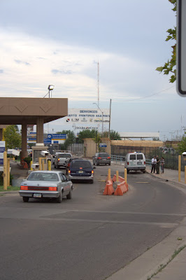
looking across customs into Mexico
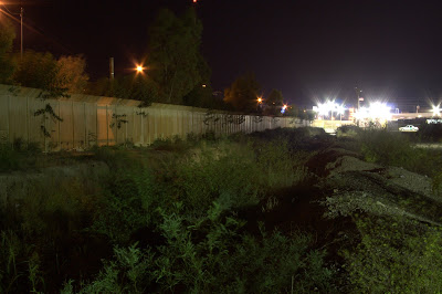
the border immediately east of Douglas
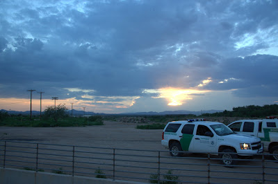
border patrol vehicles were everywhere
We have no pictures to share of the many friends we made, but we spent hours staffing this small center--at times, all night. Groups of migrants would be deported after they were caught crossing, some of them on their third or fourth attempt. We would beckon to them as they passed and offer our services--free food, water, medical service. Many would come eagerly, but others would be ushered past by their coyotes who would often taxi them back out to the desert immediately for another attempt, further compounding issues of dehydration, exhaustion, and general physical malady.
passing the time during the late night
We found that the largest groups of deportees would arrive in two shifts, around 1230am and later, around 2 or 3. These were the some of the saddest moments. We talked with men, women and children who had been displaced from their farms in poor rural regions in southern Mexico, oftentimes by US or Canadian agribusiness, and were subsequently forced to risk their lives just to put food on their plates and that of their families. We stayed open all night to give a place to stay to a group of 5 women who had been deported at 230 in the morning after crossing the desert with but a little water and office shoes. We patched dozens of blisters, gave out hundreds of burritos and bottled waters, offered pudding to children who were so severely dehydrated after more than 3 days in the desert that they had lost the drive to eat or drink, and tried our best to offer companionship to these people in their hardship. Often, I just tried to apologize for the hatred and ignorance of those who vote and form US policy, which forces countries to abandon economic borders while maintaining a human ones--essentially stealing the fundamental necessities from so many and then demanding that they simply starve, all while we united statesians sit in the lap of luxury conveniently spinning webs of hate and fear that help us sleep at night by justified our condemnation of these beautiful, loving people to death. This reality was presented on an individual basis, several hundred times everyday.
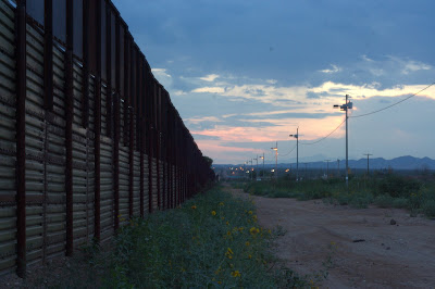
looking west along the border
You can, and should, do whatever you can to help this organization. Visit their website at nomoredeaths.org. Solve the root of the problem by working to change a broken, murderous, immigration policy (not to mention or disastrous free-trade agreements, NAFTA, CAFTA, and more). Get involved!
And please, next election remember that voting against a president who is ambivalent about abortion policy does nothing to change abortion policy as this remains in the domain of the supreme court, but voting for a racist kills thousands every year--on the border and around the world--if you want to cancel your complacency as regards these violent exploitations, vote and end your support of these atrocities.
Emily and I spent a week volunteering with No More Deaths along the US-Mexican border. No More Deaths was founded in response to the humanitarian disaster that occurs year-round in the Sonoran desert--hundreds of migrants die yearly. They run several operations in the area, ranging from a camp in the Sonoran desert that makes water drops and gives medical assistance to migrants to humanitarian aid shelters in in Nogales and Agua Prieta, Mexico for deported migrants, recently apprehended by the border patrol while crossing to the US. We worked in one of these shelters in Agua Prieta (across the border from Douglas, Arizona).

looking across customs into Mexico

the border immediately east of Douglas

border patrol vehicles were everywhere
We have no pictures to share of the many friends we made, but we spent hours staffing this small center--at times, all night. Groups of migrants would be deported after they were caught crossing, some of them on their third or fourth attempt. We would beckon to them as they passed and offer our services--free food, water, medical service. Many would come eagerly, but others would be ushered past by their coyotes who would often taxi them back out to the desert immediately for another attempt, further compounding issues of dehydration, exhaustion, and general physical malady.

passing the time during the late night
We found that the largest groups of deportees would arrive in two shifts, around 1230am and later, around 2 or 3. These were the some of the saddest moments. We talked with men, women and children who had been displaced from their farms in poor rural regions in southern Mexico, oftentimes by US or Canadian agribusiness, and were subsequently forced to risk their lives just to put food on their plates and that of their families. We stayed open all night to give a place to stay to a group of 5 women who had been deported at 230 in the morning after crossing the desert with but a little water and office shoes. We patched dozens of blisters, gave out hundreds of burritos and bottled waters, offered pudding to children who were so severely dehydrated after more than 3 days in the desert that they had lost the drive to eat or drink, and tried our best to offer companionship to these people in their hardship. Often, I just tried to apologize for the hatred and ignorance of those who vote and form US policy, which forces countries to abandon economic borders while maintaining a human ones--essentially stealing the fundamental necessities from so many and then demanding that they simply starve, all while we united statesians sit in the lap of luxury conveniently spinning webs of hate and fear that help us sleep at night by justified our condemnation of these beautiful, loving people to death. This reality was presented on an individual basis, several hundred times everyday.

looking west along the border
You can, and should, do whatever you can to help this organization. Visit their website at nomoredeaths.org. Solve the root of the problem by working to change a broken, murderous, immigration policy (not to mention or disastrous free-trade agreements, NAFTA, CAFTA, and more). Get involved!
And please, next election remember that voting against a president who is ambivalent about abortion policy does nothing to change abortion policy as this remains in the domain of the supreme court, but voting for a racist kills thousands every year--on the border and around the world--if you want to cancel your complacency as regards these violent exploitations, vote and end your support of these atrocities.
Wednesday, August 8, 2007
Clear Fluid Diet, El Paso, TX, USA

With nothing better to do, I found the SummitPost for Huayna Potosi. Someone had put up a picture looking down the final headwall in daylight, so now I can convey the feeling at 6000+ meters much better. Climbing pictures are fun.
Saturday, August 4, 2007
La Paz, Bolivia
I thought I´d share a few photos I´ve taken in La Paz. At more than 11800 ft, it is the highest capital in the world. The city itself rests inside a valley that opens up to the looming 21125 feet Mt. Illimani. I´ve been more or less just taking things easy here for the past few days, and will continue to do so--climbing Huayna Potosi wiped out my energy and I am now just feeling normal again. I have visited several interesting museums and had a good time just meeting people. Yesterday I went to the ancient ruins of Tiwanaku, and will put a post up here about that soon. Until then, here are some pictures of the city.
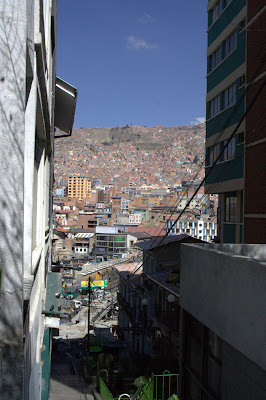
looking across the valley, all the streets just go up and up...
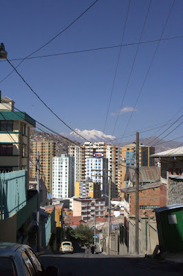
looking down the valley towards downtown, Illimani towers over the highest skyscrapers in the world.

looking across the valley, all the streets just go up and up...

looking down the valley towards downtown, Illimani towers over the highest skyscrapers in the world.
Wednesday, August 1, 2007
Summiting Huayna Potosi, 6088m, 19975ft, Cordillera Real, La Paz, Bolivia
Two days ago, I set out at 9am with my mountaineering guide Roberto to attempt the nearby peak Huayna Potosi--a 6088m mountain which sits squarely in the Cordillera Real, home to many other giant peaks.
taken during our approach
We arrived at foot of the mountain around 1030am or so, and hoofed up all our equipment--cheesy yellow plastic boots, harness, ice axe, crampons, ropes, and the other usual stuff for camping and bitter cold. Other groups used sherpas to haul their gear up to the start of the glacier, but for some reason we didn´t--though later (after I took off my 60lb pack) it made me happy to feel like I wasn´t taking shortcuts through this thing. Anyway, the hike took about 2-3 hours up through a boulderfield until we ended up a refugee potosi--a wooden shack at 5200m (17060ft) that is frequented by climbers waiting to acclimatize a bit while the time ticks away until 1am when the summit attempt begins.
The rest of the day essentially consisted of this anxious waiting around, seeing how the altitude affected us, and watching other climbers have to turn around (text-book examples of Cheney-Stokes respirations). I took several photos during this time, which would turn out to be the majority of what I captured as the upcoming cold at 20000ft around 4am would prove too much for my desires to remove my overmits to navigate the camera.
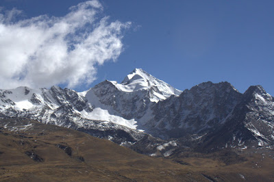
a shot up the mountain from where we stayed, this was of course a false peak--about 1/6 of the way up from there
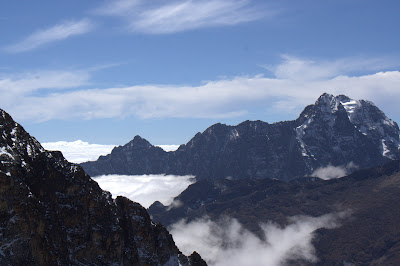
looking east towards amazonia and its cloudbank, past a few shorter mountains in the Cordillera Real
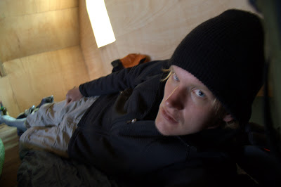
trying to relax and sleep inside the shack
The rest of the night I tried to eat aguacate and cheese sandwiches and drink mate de coca while my body rejected my attempts to sleep time and time again. I managed about an hour in total due to the altitude and a snowstorm that was happening outside--making me appreciate the refuge a little bit more. My guide Roberto (called el piano by the other guides, for why I never got a straight answer), told me it was 100 and time to suit up to go. Putting on all the gear, we stepped out into a frigid night, a fresh blanket off snow over everything, and a nearly full moon that light everything so brightly I would only turn on my lamp for knots and technical sections. Really a serene and beautiful night.
a blurry hand-held shot of Roberto advancing up the first section of glacier--shows how bright it was
So the work began, kicking on crampon in front of the next for several hours straight. It was hard work when we started, and only got more difficult as we progressed upward into thinner air. However, compared to other groups we made great time--Roberto and I quickly passed beyond all the other climbers and the entire morning was spent cutting a fresh path through the snow with nobody in sight. It was one of the more spiritual experiences I´ve ever had, just concentrating on putting one foot in front of the other in a steady rhythm while seeing all sorts of amazing glacial formations lit by this ethereal moonlight.
el piano
self-portrait
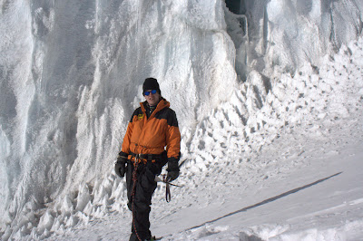
Normally, there is only one truly technical section of the climb aside from glacier travel--about 30 meters to step up to another glacier at about 50 degrees. Roberto thought I was doing fine, so he walked us over to an ice face, "mejorar escalar." We took a picture in front of it in the day on the way back down. Anyway, it was a blast--if a bit difficult at altitude.
in front of the first technical section
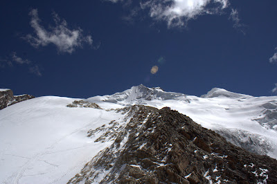
Apparently this was a test/warmup, because later Roberto told me we would be leaving the normal route. The normal ascent crosses in front of the final summit face to a ridge that one is able to follow to the peak at a steady 20 degrees. Instead, we would go straight up the face itself--climbing what he told me was 60+ degrees for the final 210+ meters (it was a bit more than 3 sections of 70m rope when we repelled back down) to reach the 6088 meter summit. So we set off, and this was durissimo--all I could do was concentrate on getting good throws of my axe, setting my toes into firm ice that wouldn´t fall out, and pressure breathing to keep my lungs as open as possible. Compounding this the most bitter wind I´ve ever felt whiping across the face of our climb--causing me to lose feeling in my toes about halfway up (damn rental plastics)... Pretty scary, but by that point there was no question about continuing to the end.
After too long of this (I really have no idea exactly how long as my mind was a little hazy at this point though Roberto told me it usually takes 40 minutes to an hour) we pulled ourselves onto the summit--later we would find out we were the first ones of the day up there. The view was amazing, as everything was lit by the moon--lake titicaca, the lights of la paz, other peaks in the cordillera real, forming clouds over the amazon basin--incredible. Unfortunately all my shots are blurry--I had lost feeling in my right foot and my right hand was coming in and out, making a stable platform a bit difficult. I went to drink from my MSR bladder, but the water had frozen! It was too cold to stay there much longer than 10 minutes, so we decided to go back down and take a longer break once the sun had presented itself.
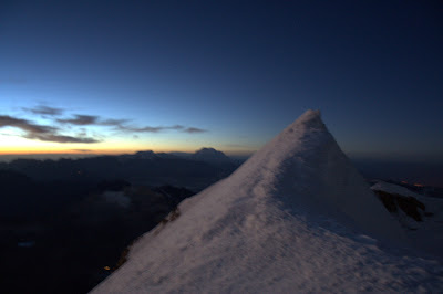
the peak of Huayna Potosi with a hint of sun starting to crawl out
on the peak, you can see the lights of La Paz in the background
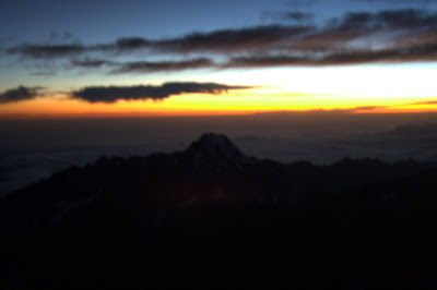
watching sunrise over amazonia
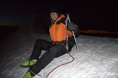
We rapelled back down the same face, and took a break at the bottom.
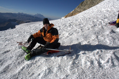
trying to rest and stay warm and breath
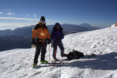
we ran into another group of climbers, and they took this picture of us
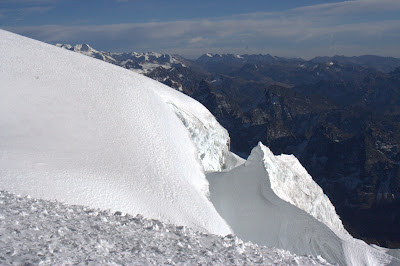
glacier formation

another
All that remained was the long walk back out, a few beers between the two of us, and a well-deserved shower.

taken during our approach
We arrived at foot of the mountain around 1030am or so, and hoofed up all our equipment--cheesy yellow plastic boots, harness, ice axe, crampons, ropes, and the other usual stuff for camping and bitter cold. Other groups used sherpas to haul their gear up to the start of the glacier, but for some reason we didn´t--though later (after I took off my 60lb pack) it made me happy to feel like I wasn´t taking shortcuts through this thing. Anyway, the hike took about 2-3 hours up through a boulderfield until we ended up a refugee potosi--a wooden shack at 5200m (17060ft) that is frequented by climbers waiting to acclimatize a bit while the time ticks away until 1am when the summit attempt begins.
The rest of the day essentially consisted of this anxious waiting around, seeing how the altitude affected us, and watching other climbers have to turn around (text-book examples of Cheney-Stokes respirations). I took several photos during this time, which would turn out to be the majority of what I captured as the upcoming cold at 20000ft around 4am would prove too much for my desires to remove my overmits to navigate the camera.

a shot up the mountain from where we stayed, this was of course a false peak--about 1/6 of the way up from there

looking east towards amazonia and its cloudbank, past a few shorter mountains in the Cordillera Real

trying to relax and sleep inside the shack
The rest of the night I tried to eat aguacate and cheese sandwiches and drink mate de coca while my body rejected my attempts to sleep time and time again. I managed about an hour in total due to the altitude and a snowstorm that was happening outside--making me appreciate the refuge a little bit more. My guide Roberto (called el piano by the other guides, for why I never got a straight answer), told me it was 100 and time to suit up to go. Putting on all the gear, we stepped out into a frigid night, a fresh blanket off snow over everything, and a nearly full moon that light everything so brightly I would only turn on my lamp for knots and technical sections. Really a serene and beautiful night.

a blurry hand-held shot of Roberto advancing up the first section of glacier--shows how bright it was
So the work began, kicking on crampon in front of the next for several hours straight. It was hard work when we started, and only got more difficult as we progressed upward into thinner air. However, compared to other groups we made great time--Roberto and I quickly passed beyond all the other climbers and the entire morning was spent cutting a fresh path through the snow with nobody in sight. It was one of the more spiritual experiences I´ve ever had, just concentrating on putting one foot in front of the other in a steady rhythm while seeing all sorts of amazing glacial formations lit by this ethereal moonlight.

el piano

self-portrait
Normally, there is only one truly technical section of the climb aside from glacier travel--about 30 meters to step up to another glacier at about 50 degrees. Roberto thought I was doing fine, so he walked us over to an ice face, "mejorar escalar." We took a picture in front of it in the day on the way back down. Anyway, it was a blast--if a bit difficult at altitude.

in front of the first technical section
Apparently this was a test/warmup, because later Roberto told me we would be leaving the normal route. The normal ascent crosses in front of the final summit face to a ridge that one is able to follow to the peak at a steady 20 degrees. Instead, we would go straight up the face itself--climbing what he told me was 60+ degrees for the final 210+ meters (it was a bit more than 3 sections of 70m rope when we repelled back down) to reach the 6088 meter summit. So we set off, and this was durissimo--all I could do was concentrate on getting good throws of my axe, setting my toes into firm ice that wouldn´t fall out, and pressure breathing to keep my lungs as open as possible. Compounding this the most bitter wind I´ve ever felt whiping across the face of our climb--causing me to lose feeling in my toes about halfway up (damn rental plastics)... Pretty scary, but by that point there was no question about continuing to the end.
After too long of this (I really have no idea exactly how long as my mind was a little hazy at this point though Roberto told me it usually takes 40 minutes to an hour) we pulled ourselves onto the summit--later we would find out we were the first ones of the day up there. The view was amazing, as everything was lit by the moon--lake titicaca, the lights of la paz, other peaks in the cordillera real, forming clouds over the amazon basin--incredible. Unfortunately all my shots are blurry--I had lost feeling in my right foot and my right hand was coming in and out, making a stable platform a bit difficult. I went to drink from my MSR bladder, but the water had frozen! It was too cold to stay there much longer than 10 minutes, so we decided to go back down and take a longer break once the sun had presented itself.

the peak of Huayna Potosi with a hint of sun starting to crawl out

on the peak, you can see the lights of La Paz in the background

watching sunrise over amazonia
We rapelled back down the same face, and took a break at the bottom.

trying to rest and stay warm and breath

we ran into another group of climbers, and they took this picture of us

glacier formation

another
All that remained was the long walk back out, a few beers between the two of us, and a well-deserved shower.
Sunday, July 29, 2007
Estoy Aqui, La Paz, Bolivia
I just arrived in La Paz this morning on the night bus at 5am. I´m checked into a hotel and all is well.
This city is incredibly beautiful and freezing. We are literally sitting up in the clouds at 12000 feet--the highest capital in the world. I am spending today walking through labyrinths of winding narrow stone streets. Tomorrow afternoon I will climb to Lago Titicaca, the highest lake of its size in the world (navegable at something like 14000 feet). There I will take a boat to Isla del Sol--the birthplace of civilization in the Andino Cosmovision. I plan to rent a tent and camp either there or on the smaller Isla del Luna--the two are supposed to be amazingly beautiful (and freezing tambien).
After that plans are not set, but one could just sit and watch this amazing city for days. Photos to come.
Friday, July 27, 2007
Ultimo Dia, Cochabamba, Bolivia

all the students in my class
A sad day, my last studying in Coch. I´m going to miss this beautiful place, my host family, and all the friends I´ve made here. I just keep telling myself I´ll be able to come back in the future and that makes it better. A friend, Daniel, a Dominican, sent me a link to his web album of photos from our time here. I picked out a few more photos, and you can see the whole thing here. He took some good shots of the city, at times I never had my camera and some other shots that are neat too.

a concert we attended of the bolivian group called negro y blanco
 after our hike up cerro tunari
Tuesday, July 24, 2007
Villa Tunari, Chapare Province, Cochabamba, Bolivia
This weekend I hitched a ride in a van with some others and was able to visit a totally different environment of Cochabamba--Villa Tunari in the Chapare. This region essentially sits on the western edge of the Amazon Basin and is dominated by tropical forests. To get there, one drops down out of the Andes from 8500 feet in the Cochabamba Valley to about 900 feet in the Chapare.
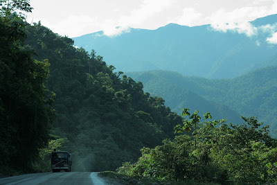
This road is dominated by large camiones that haul a variety of goods out of the Amazon, over the Andes to the sea, for sale in other locales (like albertsons). Fruits of all varieties, lumber, and oil are just a few of the exports.
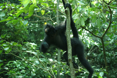
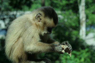
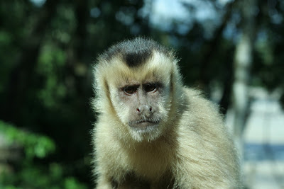
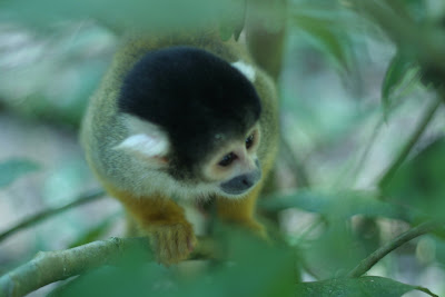
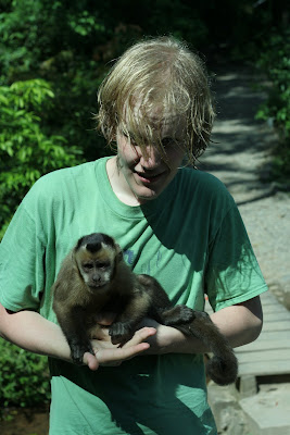
Our first stop was Parque Machia--a wildlife refuge for pumas, monkeys, and other creatures; but especially monkeys. They are not timid, and will come right up to you. This entire weekend I shot with my 50mm prime lens, so I had no zoom--I had no problem getting up close for the next several shots, and the monkeys had no problem either.
2001: A Space Odyssey
a sweaty me with a friendly monkey doing its business
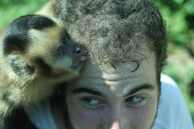
he was more direct with my friend Thomas
There was also a nice trail that lead up a small hillside to a great panoramic view of the Villa Tunari area (where we stayed) of the Chapare.
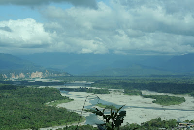
The Chapare near Pueblo Villa Tunari
That night, we crashed in a hostal that cost us 30 bolivianos a piece (2.50 US) that was run by the director of the Andean Information Network. This group runs information campaigns in english about the problems and abuses of the Campesino population in Bolivia. We drunk some beer and played cards until early in the morning. You can, and should, visit their website here.
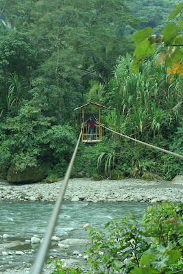
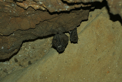
The next morning, we got up for sunrise and mass (yes mom, mass--the seminarians keep me in line...), and then headed to Parque Carrasco, which protects an area of beautiful cloud forest home to bats and a rare endangered species of bird that lives in caves (I forget the name, but I have seen them before in an episode of Planet Earth before I left) You have to cross a river by cable car to access the jungle.
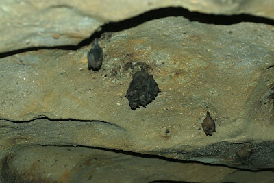
We entered a pitch-black cavern, and I got some lucky manually-focused shots of some murcielagos.
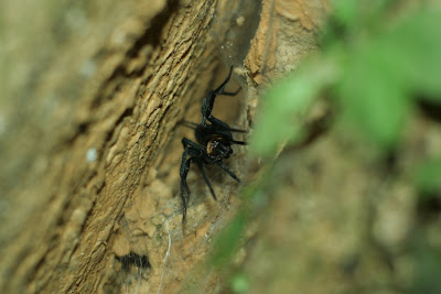
and a spider...
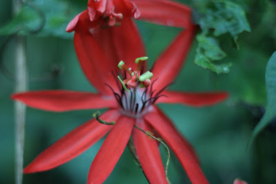
a flower in the forest, the 1.8 f-stop makes for a pleasant focus
It was most certainly a jungle, complete with massive trees and thick vines. The vines were able to hold the weight of a body, so of course I took advantage of that...
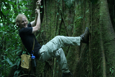
escalando
Another aspect about the Chapare is that it is one of two Amazonian regions of Bolivia where Coca is readily grown. We saw a coca field in the park, tended by campesinos who have lived here for ages and done the same thing--long before cocaine. The coca leaf is not a drug, it is a milder stimulant than coffee and contains 14 alkaloids that are able to help suppress hunger, give energy, combat the effects of altitude, and act as an antiseptic/digestional aid--among dozens of other benefits. I have used it for all these things, and the campesinos in their work most certainly need its aid. The problem with Coca arises when someone extracts one of the 14 alkaloids and concentrates it into Cocaine--and this problem is generated by the addicts, not the growers. Nonetheless, the US used to regularly spray this area of Bolivia with an analog of agent orange--effectively destroying hundreds hectares upon hectares of Rainforest and Cropland, along with any meager profits that the imporverished local population might enjoy. Spraying currently goes on at full pace in Columbia, under the name Plan Columbia--along with US-funded troop deployments that have been linked to hundreds, if not thousands, of deaths and violations. Visit the Andean Information Network link for more information about the current state of this problem in Bolivia. Anyway, we saw a coca field which was a pretty cool chance to witness the source of so much contemporary intervention by the states.
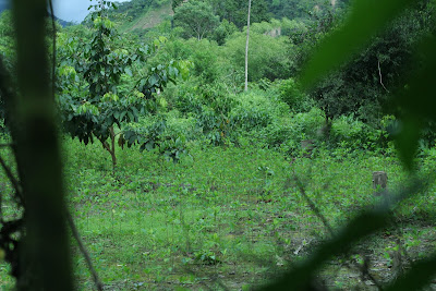
a coca field
One the way back out, I asked the guide if I could cross the river like the Campesino farmers (which we had seen earlier). He said it was possible and gave me a rope and hook with which I hung myself from the cable that crossed the river. It was a good time, and something else to have seen 40/50 year old women cross in the same manner.
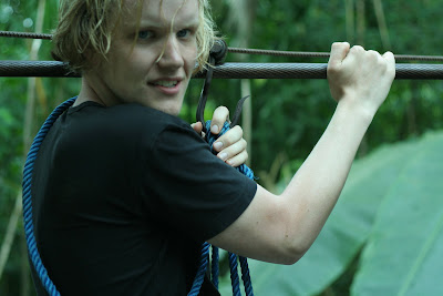
roping up
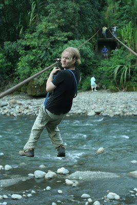
para crusar
It was a good time. Afterward, we heading back through a rainstorm (the first storm I´ve seen in Bolivia--if the ice/snow storm on top of Tunari is overlooked) and got back into town around 10pm. A great weekend overall, and a experience more like that of El Salvador than Alpine Bolivia.

This road is dominated by large camiones that haul a variety of goods out of the Amazon, over the Andes to the sea, for sale in other locales (like albertsons). Fruits of all varieties, lumber, and oil are just a few of the exports.
Our first stop was Parque Machia--a wildlife refuge for pumas, monkeys, and other creatures; but especially monkeys. They are not timid, and will come right up to you. This entire weekend I shot with my 50mm prime lens, so I had no zoom--I had no problem getting up close for the next several shots, and the monkeys had no problem either.


2001: A Space Odyssey


a sweaty me with a friendly monkey doing its business

he was more direct with my friend Thomas
There was also a nice trail that lead up a small hillside to a great panoramic view of the Villa Tunari area (where we stayed) of the Chapare.

The Chapare near Pueblo Villa Tunari
That night, we crashed in a hostal that cost us 30 bolivianos a piece (2.50 US) that was run by the director of the Andean Information Network. This group runs information campaigns in english about the problems and abuses of the Campesino population in Bolivia. We drunk some beer and played cards until early in the morning. You can, and should, visit their website here.
The next morning, we got up for sunrise and mass (yes mom, mass--the seminarians keep me in line...), and then headed to Parque Carrasco, which protects an area of beautiful cloud forest home to bats and a rare endangered species of bird that lives in caves (I forget the name, but I have seen them before in an episode of Planet Earth before I left) You have to cross a river by cable car to access the jungle.

We entered a pitch-black cavern, and I got some lucky manually-focused shots of some murcielagos.


and a spider...

a flower in the forest, the 1.8 f-stop makes for a pleasant focus
It was most certainly a jungle, complete with massive trees and thick vines. The vines were able to hold the weight of a body, so of course I took advantage of that...

escalando
Another aspect about the Chapare is that it is one of two Amazonian regions of Bolivia where Coca is readily grown. We saw a coca field in the park, tended by campesinos who have lived here for ages and done the same thing--long before cocaine. The coca leaf is not a drug, it is a milder stimulant than coffee and contains 14 alkaloids that are able to help suppress hunger, give energy, combat the effects of altitude, and act as an antiseptic/digestional aid--among dozens of other benefits. I have used it for all these things, and the campesinos in their work most certainly need its aid. The problem with Coca arises when someone extracts one of the 14 alkaloids and concentrates it into Cocaine--and this problem is generated by the addicts, not the growers. Nonetheless, the US used to regularly spray this area of Bolivia with an analog of agent orange--effectively destroying hundreds hectares upon hectares of Rainforest and Cropland, along with any meager profits that the imporverished local population might enjoy. Spraying currently goes on at full pace in Columbia, under the name Plan Columbia--along with US-funded troop deployments that have been linked to hundreds, if not thousands, of deaths and violations. Visit the Andean Information Network link for more information about the current state of this problem in Bolivia. Anyway, we saw a coca field which was a pretty cool chance to witness the source of so much contemporary intervention by the states.

a coca field
One the way back out, I asked the guide if I could cross the river like the Campesino farmers (which we had seen earlier). He said it was possible and gave me a rope and hook with which I hung myself from the cable that crossed the river. It was a good time, and something else to have seen 40/50 year old women cross in the same manner.

roping up

para crusar
It was a good time. Afterward, we heading back through a rainstorm (the first storm I´ve seen in Bolivia--if the ice/snow storm on top of Tunari is overlooked) and got back into town around 10pm. A great weekend overall, and a experience more like that of El Salvador than Alpine Bolivia.
Subscribe to:
Posts (Atom)