nuestro unico problema es que nos falta chicha

Friday, July 20, 2007

Reality, Cochabamba, Bolivia


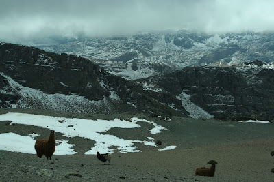
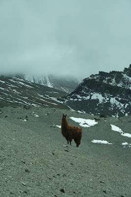
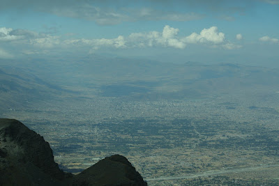
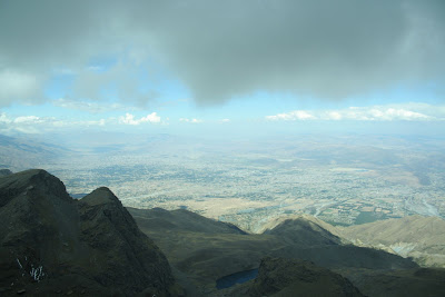
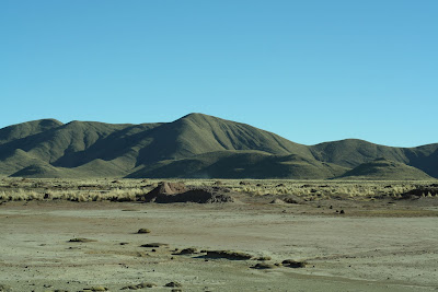
I realized that most of this blog has been devoted to my adventures down here. I´ve really spoken little about what I´ve actually been DOING for the 5 days in the week, but only my brief side trips to other lugares. Somewhat atypically me, I guess, so now I start my attempt to bring in other, more important, aspects of my trip. Because the reality of the situation is that Bolivia is incredibly complex, progressive, and illuminative of both the history, present, and future of our global socio-economic system. I don´t have time to write anything long here, nor do I really want to, but I thought I might start with two quick links to get people started.

First, an excellent film that I just recently saw called The Devil´s Miner. This film profiles current working conditions in a silver mine near Potosi, Boliva which is called Cerro Rico (loosely, Rich Mountain--rico is a all-use word for rich, tasty, good, and much more in Bolivia). This mine was opened by the Spanish Conquistadores who forced the native populations into forced labor where a person would have to work in the mines for 6 months strait never seeing the light of day. Today, not much has changed. This movie is shot in the style of Mexican Realism and really carries a powerful impact on the viewer. If you want to experience just a tiny bit of the devasting exploitation of south america--you should see this movie. You´ll see a link in the bottom right of the above-linked website where you can both see a preview and purchase a copy of the film. If you don´t like it, I´ll buy the copy from you when I get back as I will surely be getting it for my library. An excellent work.


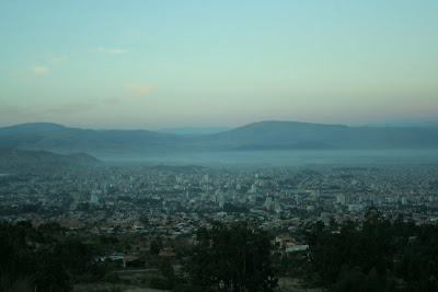
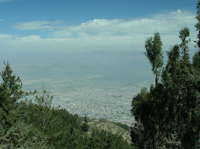
Second, the Democracy Center´s Blog from Bolivia, which has and continues to give an excellent account of current events--of which there are many. I had the opportunity to meet the writer, who is an excellent person, and also was a key player in breaking the story about the US-based Bechtel Corporation´s exploitative and illegal contract for ownership of the water-supply of Cochabamba--this left people paying over 20 dollars a month for water when they only made 80 and oftentimes stole home-made wells from the campesinos. Jim played a critical role in ending this contract via massive education and mobilization of the people--today this supernational country-of-a-corporation is gone, though water problems remain and Bechtel is doing the same thing (and getting away with it) in other places throughout the world thanks to malicious contracting on part of the US-elected World Bank.

Great, hopefully this is a decent start. In the future I will do my best to try and unpack certain aspects of the current political and economic climate here as I perceive them from my time and conversations spent here.

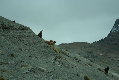
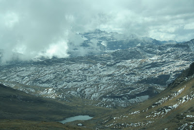
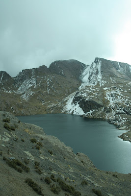
If you are thinking "I don´t want any of this," just hang around for 3 days--tomorrow morning I leave for the Chapare, a tropical region of Bolivia. This area is one of the more politically active areas and also home to monos ladrones/rainforests. Thanks for reading, plenty more to come in my last few weeks here...

Monday, July 16, 2007

Climbing Machu Tunari--16,600ft, Parque Nacional Tunari, Cochabamba, Bolivia

Last Sunday was one of the most breathtaking things I´ve had the opportunity to do so far in Bolivia--also the hardest. We made it to top of the mountain, and then to another mountain a thousand feet or so lower so we could see the Valley of Cochabamba.


nearing the top

Another student, Daniel, and I left Cochabamba around 630 in the morning along with our guide, Grover, and drove up onto the altiplano north of Cochabamba. The trip took about 2 hours due to the conditions of a narrow mountain pass that we followed, but the scenery was beautiful and we were able to see many campesino pueblos (some people of which Grover knew personally).


domestic llamas by the road

We reached our point of departure--which was probably around 12,000ft--around 900, packed some coca leaves to help with the altitude which was already apparent, and headed out. It was readily apparent that we were going into some pretty rough weather--snow, ice, and a biting wind made conditions pretty poor. For example, the camelbak hose of my friend Daniel froze about halfway up the mountain. The first step was scaling many feet of loose shale-like rock that surrounded the jagged peak.


on the loose shale and in the clouds

We progressed onto hard rock/snow and into more of the storm.


the final several hundred feet follow the edge of this abyss

After enduring the storm inside the clouds for about 2.5 hours we made it to the top, we things were so bad I couldn´t keep my camera lens clear for more than a few seconds at a time.


on the peak

There are bizarre fossils of what Grover told us were worms and, if I translated correctly, crustaceans, on the peak--remains of an ancient sea that once covered all of Bolivia (see below).


on top


posing below the peak now, the top is far above in the clouds


our guide wouldn´t let me sleep on the ice sheets

A bit lower when we could take decent photos, we posed with a can of Taquiña, the local beer, which bears the peak of Tunari on its label. Also evident is the sheet of ice around my exposed hair.


After about an hour of ski-ing/sliding/controlled falling down the backside of Tunari, we came out below the clouds and spotted this mountain in the distance. It was more or less clear of clouds, and we wanted to see the view of Cochabamba, so we decided to head over.


the most distant peak was our objective


the scenery was like photos I´ve seen of Nepal--they call Bolivia the Nepal of the Andes for good reason


a little bit closer, we followed this ridge over to what we called machito tunari


we encountered a herd of wild llamas on these ridiculously high slopes


she was my favorite, and the most photogenic

We made it to this next peak after about 3 more hours of high-altitude scrambling--by this time the height was started to really sap our energy and it made it hard to keep up the pace we had set earlier (then out of necessity so we didn´t freeze!)


the vast expanse of the cochabamba valley--if you follow the picture, blow it up, and squint, you can barely make out the gigantic cristo towering over downtown--we were high...


and another a bit more to the right

Going back was hard. The detour to the other mountain cross several deep ravine/valleys, so we had to scale the same several hundred feet multiple times along the way.


the wild llamas wondering what the hell we were doing--on the right you can see the ridge leading up to clouds and the invisible peak of tunari


From the slope that would eventually take us to our landrover... Seriously, like Nepal


a laguna

And we made it back to the truck around 5pm--leaving a tour hour car ride to Cochabamba across the same crazy mountain road, pizza and taquiña, the final of copa america, and an early bed at 9pm.

Hacia harto frio.

Wednesday, July 11, 2007

El Parque Nacional Tunari, Cochabamba, Bolivia


during lunch

This past weekend, myself and 3 others went to part of Parque Nacional Tunari, directly north of Cochabamba. We started out early in the morning and hiked up to the tree line, which took about 7 hours to get to and a bit of route finding. The hike itself was more or less straight uphill, but afforded some amazing vistas of Cochabamba and the surrounding mountains as well as a look into certain maneras of the people in the nearby hills.


Cochabamba in the morning, just as we started


another photo, about 3/4 up the mountain

During the hike, we ran into several campesinos who were living on the hillside. Particularly memorable was a woman who we asked as to where we might find water (which was a problem for though lagunas are listed on the map, they turned out to be much further than we had thought). When she responded we realized she spoke only Quechua, one of the native tongues--but she did help get us back on the trail. I took the following shot of her tending to a herd of sheep after we had gotten a ways further up the mountainside. Our elevation relative to Coch is also apparent in this photo.


The rest of the day was uneventful, and my boots kept my toes from getting banged up into the toebox on the way back down--a welcome change from the grand canyon. It was a 12 hour day hike, but a lot of fun.

Next sunday, myself and a fellow student from Colorado are going to attempt to summit Cerro Tunari. The highest peak in the this Cordillera at 16,700 feet. We´ll be taking a local guide and it should be really great--especially because there is now snow dusting the peak due to a freak snowstorm that happened in the higher altitudes of Bolivia yesterday. I am prepared with long underwear, a waterproof outershell, and boots made from hiking in winter in the mountains, among other things--so it should just be a challenging high altitude summit. It takes about 4 hours up, and 2 back down. I am excited to share those photos...

Sunday, July 1, 2007

The Salar de Uyuni, Uyuni, Bolivia

We headed out around 1030 in a landrover with a guide, a japanese man, a french woman and her mexican husband (they spoke french, spanish, and english), and another french woman who was from southern france and a riot. The couple had been touring the world for over a year, and were now finishing up with 3 months left to ascend from the tip of Argentina to Mexico where they planned to start a biofarm. The lone french woman had come to South America to follow the steps of her hero Che Guevera--a trip which would culminate at his place of death in Bolivia upon the celebration of its anniversary. They were great partners for the trip, and it was fun to converse with French being translated into Spanish and vice versa.

The Salar, recently named a wonder of the world by the Times UK, is a 4024 square mile expanse of salt--making it the largest salt flat in the world. At 3650m, or 12000 feet, it´s probably the highest too. There are tours of 4+ days offered of the flats, but since we were on a limited schedule we elected for just a 1 day excursion. Volcanoes, colored lakes, and bizarre rock formations scatter the corners of the flats--called Salvador Dali´s desert by some--and are accessible on longer tours. Going there in the winter is also quite frigid, with temperatures plumetting far below 0 at night and not getting much better due to wind in the daytime.


My polarizing filter and a quick shutter helped control the blast of sunlight that were the salt flats.


Indigenous locals shovel and process the salt for human consumption--exporting nearly 25000 tons a year from the flats. The salt is scooped into piles, and the piles are scooped into trucks.


About halfway through the day, after driving at 65mph+ through the flats, we stopped at an "island" in the interior of the Salar for lunch. Bizarre cacti grow there, reminiscent of southern arizona--but in a sea of salt.


At this point, I was talking with the french couple about what might be wrong with me and they told me they were having trouble with altitude sickness themselves. They were taking a "natural" red and white pill which solved their problems. After being offered one, I eagerly took it as I was starving for calories to keep myself warm and within twenty minutes my problems were similarly solved. Having lunch was nice.


able to move around again!


an arrangement of flags outside a hotel made of salt on the salar

After a few more hours, we drove back off the Salar and into Uyuni. First stopping by a desolate gathering of more than a dozen rusted train engines. Our guide explained to us that they were leftovers from the mining boom which saw the forced exploitation of Bolivia´s vast mineral resources. The mining companies simply had left them to rust next to the track that goes from Uyuni to Chile and Argentina. Another example of the abuses and exploitations Bolivians have suffered throughout history.


just a glimpse of the spread of rust


traveling

We got back into town around 630, and had wine and pizza with the french folk until our train left at 9pm for Oruru, connected in Oruru for Cochabamba at 6am, and got into town around noon today. It was an experiment in sleep deprivation, but certainly worth it. I´d like to go back again sometime and do a full 4 day trip, it has to be one of the most surreal environments I´ve ever encountered. Hopefully I´ll meet up again with the couple when they make their way through Cochabamba on their way north.

The Altiplano by Train, From Oruru to Uyuni, Bolivia

This weekend was a marathon. A friend and I decided to visit the Salar de Uyuni and as such piled into a bus from Cochabamba to Oruru early friday morning. When we arrived in Oruru, we bought tickets for a train across the Altiplano to Uyuni, where we would hook up with a guide to take us onto the salt flats.

I had no idea what a surreal place the desolate, over 3500m high altiplano would be. That such a strikingly flat place exists at an altitude higher than anything but a few brief peaks in the continental states is mindblowing. I was glad I had my camera in the train for the seven hour ride across just a bit of it.


Once and awhile, a herd of llamas or vicuñas could be spoted from the train, as well as flocks of pink flamingos who seemed to enjoy meandering in the few lakes we saw. All the wildlife was too far for my lens.


a mirage like effect across the expanse at sunset

We got into town after 12, around which time I let it all hang out as I got sick and stayed sick for most the night--perched over a toilet. I couldn´t catch my breath, sleep, or keep any food down. The next morning, I didn´t feel much better but we had already come 16 hours to see the Salar so I swung by the farmacia for some dramamine and pushed on.

Wednesday, June 20, 2007

IDIEM, Cochabamba, Bolivia

Here are a few pictures of the institute, they are no good and I will take better ones in the future. The first is out the window of my classroom, and the second is from a garden where I can study.


from my classroom


outside study/eating area

There are mountains in the background, you just can´t see them well through the trees inside the institute.

Tuesday, June 19, 2007

Estoy Aqui, Cochabamba, Bolivia

I am here. It is great. I have to eat lunch, but will hopefully hit up a computer station a bit later today. Short messages are sometimes better, especially when there is too much to say.

Que Rico.

Friday, June 15, 2007

Stranded in Miami, Miami Beach, FL, USA

There were severe delays in Houston last night. This meant that american couldn't get me into miami until 2am, over 5 hours late. I missed my connection into La Paz, and my subsequent connection into Cochabamba. I leave for Bolivia tonight at 2320, and hopefully will get a boleta to Cochabamba for an arrival of 1540 tommorow.

I did get to sleep in front of a explosion containment case for potential airport bombs (hello CIA keyword grabber software). It was quite exciting.

I also have the full day to spend in Miami, so I am writing this post from a library in Miami beach--just a 1.50 bus fare away from that hellish airport and its overpriced commodities (though food is no cheaper out here, but there's a beach). There is definitely a huge cubano population here, most people seem to speak spanish. The highlight was getting out of the airport in time to see the sunrise over the ocean. So not a terrible layover, but still an unwanted hassle--even if it was to a supposed "tropical paradise."

Can't wait to actually get to Bolivia...

Tuesday, June 12, 2007

false color infrared

I had a bit of time this morning to play around with photoshop and came up with this false color processing of an infrared from monument valley. I wanted to subdue the red added by the filter.


Also, I watched a few episodes of the BBC's "Planet Earth" on Sunday and it's one of the better documentaries I've seen. It's out for rental now and certainly worth it.

Saturday, June 9, 2007

Four Corners Area, AZ-UT-CO-NM, USA

We drove to the four corners area next, which allowed us to continue our scenic overload and recuperate from the canyon. First stop was Monument Valley Navajo Tribal Park, which was incredibly windy yet serene.


infrared shot of the totem poles


the mittens


the three sisters


forgot the name, but a nice picture


sunset


We drove through the four corners on our way to our next stop, being sure to stand on the cardinal axis that divides the four states. It cost 3 dollars a person, but we did get some fry bread (for 6 dollars). Not bad.


We arrived at Mesa Verde National Park--home to one of the densest groupings of ancestral pueblo ruins yet found. The park homepage has more about the detailed and interesting history. We were able to see a multitude of these sites.


Spruce Tree House


Spruce Tree House

The circular opening in the ground you can see in the above picture is an example of a kiva, which served as a religious ceremony site for ancestral puebloans. The park service restored one of these kivas, as they normally have a sealed roof (which since has eroded away on unrestored sites). We could climb down into it.


inside a kiva


spruce tree house


That night we went into town for the oft-loved pizza and microbrew combo at a local brewer--main street/mesa cerveza. They made a great one called schnorzenboomer doppelboch and sold it to go.

The next morning we woke up and took a guided tour of balcony house, another ruin at mesa verde. One must climb up a long ladder to reach this secluded ruin.


the balcony, for which this ruin is named, is visible in the foreground


exploring balcony house


balcony house kiva


balcony house


balcony house


the tunnel leaving the "house"

After we left Mesa Verde, all that remained was a long drive through New Mexico and a stop by REI for new boots.