I just arrived in La Paz this morning on the night bus at 5am. I´m checked into a hotel and all is well.
This city is incredibly beautiful and freezing. We are literally sitting up in the clouds at 12000 feet--the highest capital in the world. I am spending today walking through labyrinths of winding narrow stone streets. Tomorrow afternoon I will climb to Lago Titicaca, the highest lake of its size in the world (navegable at something like 14000 feet). There I will take a boat to Isla del Sol--the birthplace of civilization in the Andino Cosmovision. I plan to rent a tent and camp either there or on the smaller Isla del Luna--the two are supposed to be amazingly beautiful (and freezing tambien).
After that plans are not set, but one could just sit and watch this amazing city for days. Photos to come.
Sunday, July 29, 2007
Friday, July 27, 2007
Ultimo Dia, Cochabamba, Bolivia

all the students in my class
A sad day, my last studying in Coch. I´m going to miss this beautiful place, my host family, and all the friends I´ve made here. I just keep telling myself I´ll be able to come back in the future and that makes it better. A friend, Daniel, a Dominican, sent me a link to his web album of photos from our time here. I picked out a few more photos, and you can see the whole thing here. He took some good shots of the city, at times I never had my camera and some other shots that are neat too.

a concert we attended of the bolivian group called negro y blanco
 after our hike up cerro tunari
Tuesday, July 24, 2007
Villa Tunari, Chapare Province, Cochabamba, Bolivia
This weekend I hitched a ride in a van with some others and was able to visit a totally different environment of Cochabamba--Villa Tunari in the Chapare. This region essentially sits on the western edge of the Amazon Basin and is dominated by tropical forests. To get there, one drops down out of the Andes from 8500 feet in the Cochabamba Valley to about 900 feet in the Chapare.
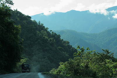
This road is dominated by large camiones that haul a variety of goods out of the Amazon, over the Andes to the sea, for sale in other locales (like albertsons). Fruits of all varieties, lumber, and oil are just a few of the exports.
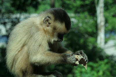
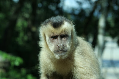
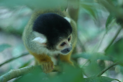
Our first stop was Parque Machia--a wildlife refuge for pumas, monkeys, and other creatures; but especially monkeys. They are not timid, and will come right up to you. This entire weekend I shot with my 50mm prime lens, so I had no zoom--I had no problem getting up close for the next several shots, and the monkeys had no problem either.
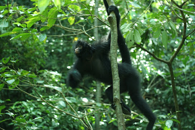
2001: A Space Odyssey
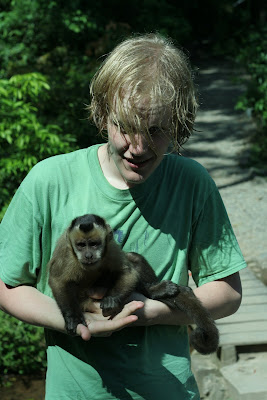
a sweaty me with a friendly monkey doing its business
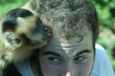
he was more direct with my friend Thomas
There was also a nice trail that lead up a small hillside to a great panoramic view of the Villa Tunari area (where we stayed) of the Chapare.
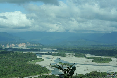
The Chapare near Pueblo Villa Tunari
That night, we crashed in a hostal that cost us 30 bolivianos a piece (2.50 US) that was run by the director of the Andean Information Network. This group runs information campaigns in english about the problems and abuses of the Campesino population in Bolivia. We drunk some beer and played cards until early in the morning. You can, and should, visit their website here.
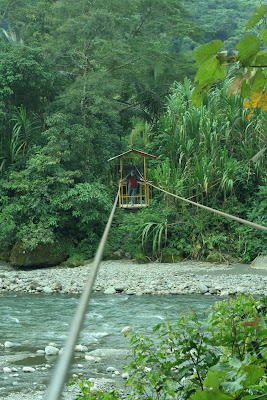
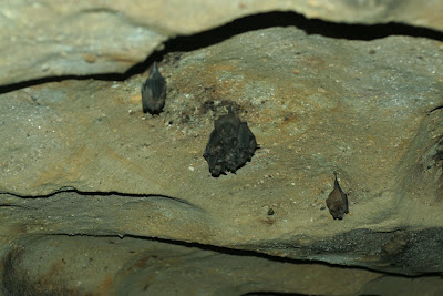
The next morning, we got up for sunrise and mass (yes mom, mass--the seminarians keep me in line...), and then headed to Parque Carrasco, which protects an area of beautiful cloud forest home to bats and a rare endangered species of bird that lives in caves (I forget the name, but I have seen them before in an episode of Planet Earth before I left) You have to cross a river by cable car to access the jungle.
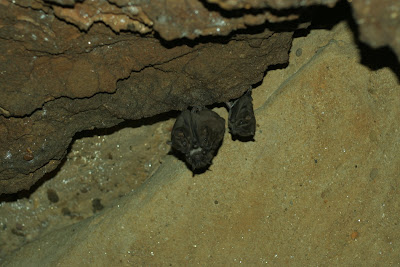
We entered a pitch-black cavern, and I got some lucky manually-focused shots of some murcielagos.
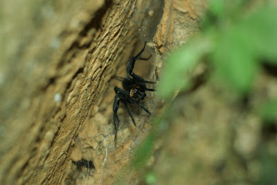
and a spider...
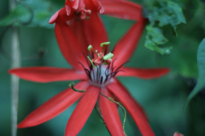
a flower in the forest, the 1.8 f-stop makes for a pleasant focus
It was most certainly a jungle, complete with massive trees and thick vines. The vines were able to hold the weight of a body, so of course I took advantage of that...
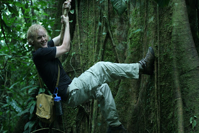
escalando
Another aspect about the Chapare is that it is one of two Amazonian regions of Bolivia where Coca is readily grown. We saw a coca field in the park, tended by campesinos who have lived here for ages and done the same thing--long before cocaine. The coca leaf is not a drug, it is a milder stimulant than coffee and contains 14 alkaloids that are able to help suppress hunger, give energy, combat the effects of altitude, and act as an antiseptic/digestional aid--among dozens of other benefits. I have used it for all these things, and the campesinos in their work most certainly need its aid. The problem with Coca arises when someone extracts one of the 14 alkaloids and concentrates it into Cocaine--and this problem is generated by the addicts, not the growers. Nonetheless, the US used to regularly spray this area of Bolivia with an analog of agent orange--effectively destroying hundreds hectares upon hectares of Rainforest and Cropland, along with any meager profits that the imporverished local population might enjoy. Spraying currently goes on at full pace in Columbia, under the name Plan Columbia--along with US-funded troop deployments that have been linked to hundreds, if not thousands, of deaths and violations. Visit the Andean Information Network link for more information about the current state of this problem in Bolivia. Anyway, we saw a coca field which was a pretty cool chance to witness the source of so much contemporary intervention by the states.
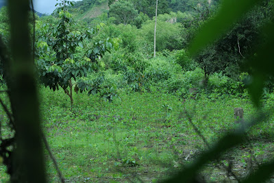
a coca field
One the way back out, I asked the guide if I could cross the river like the Campesino farmers (which we had seen earlier). He said it was possible and gave me a rope and hook with which I hung myself from the cable that crossed the river. It was a good time, and something else to have seen 40/50 year old women cross in the same manner.
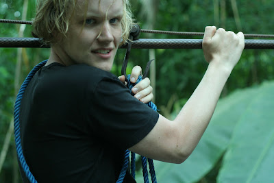
roping up
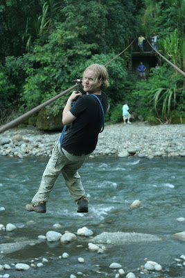
para crusar
It was a good time. Afterward, we heading back through a rainstorm (the first storm I´ve seen in Bolivia--if the ice/snow storm on top of Tunari is overlooked) and got back into town around 10pm. A great weekend overall, and a experience more like that of El Salvador than Alpine Bolivia.
This road is dominated by large camiones that haul a variety of goods out of the Amazon, over the Andes to the sea, for sale in other locales (like albertsons). Fruits of all varieties, lumber, and oil are just a few of the exports.
Our first stop was Parque Machia--a wildlife refuge for pumas, monkeys, and other creatures; but especially monkeys. They are not timid, and will come right up to you. This entire weekend I shot with my 50mm prime lens, so I had no zoom--I had no problem getting up close for the next several shots, and the monkeys had no problem either.
2001: A Space Odyssey
a sweaty me with a friendly monkey doing its business
he was more direct with my friend Thomas
There was also a nice trail that lead up a small hillside to a great panoramic view of the Villa Tunari area (where we stayed) of the Chapare.
The Chapare near Pueblo Villa Tunari
That night, we crashed in a hostal that cost us 30 bolivianos a piece (2.50 US) that was run by the director of the Andean Information Network. This group runs information campaigns in english about the problems and abuses of the Campesino population in Bolivia. We drunk some beer and played cards until early in the morning. You can, and should, visit their website here.
The next morning, we got up for sunrise and mass (yes mom, mass--the seminarians keep me in line...), and then headed to Parque Carrasco, which protects an area of beautiful cloud forest home to bats and a rare endangered species of bird that lives in caves (I forget the name, but I have seen them before in an episode of Planet Earth before I left) You have to cross a river by cable car to access the jungle.
We entered a pitch-black cavern, and I got some lucky manually-focused shots of some murcielagos.
and a spider...
a flower in the forest, the 1.8 f-stop makes for a pleasant focus
It was most certainly a jungle, complete with massive trees and thick vines. The vines were able to hold the weight of a body, so of course I took advantage of that...
escalando
Another aspect about the Chapare is that it is one of two Amazonian regions of Bolivia where Coca is readily grown. We saw a coca field in the park, tended by campesinos who have lived here for ages and done the same thing--long before cocaine. The coca leaf is not a drug, it is a milder stimulant than coffee and contains 14 alkaloids that are able to help suppress hunger, give energy, combat the effects of altitude, and act as an antiseptic/digestional aid--among dozens of other benefits. I have used it for all these things, and the campesinos in their work most certainly need its aid. The problem with Coca arises when someone extracts one of the 14 alkaloids and concentrates it into Cocaine--and this problem is generated by the addicts, not the growers. Nonetheless, the US used to regularly spray this area of Bolivia with an analog of agent orange--effectively destroying hundreds hectares upon hectares of Rainforest and Cropland, along with any meager profits that the imporverished local population might enjoy. Spraying currently goes on at full pace in Columbia, under the name Plan Columbia--along with US-funded troop deployments that have been linked to hundreds, if not thousands, of deaths and violations. Visit the Andean Information Network link for more information about the current state of this problem in Bolivia. Anyway, we saw a coca field which was a pretty cool chance to witness the source of so much contemporary intervention by the states.
a coca field
One the way back out, I asked the guide if I could cross the river like the Campesino farmers (which we had seen earlier). He said it was possible and gave me a rope and hook with which I hung myself from the cable that crossed the river. It was a good time, and something else to have seen 40/50 year old women cross in the same manner.
roping up
para crusar
It was a good time. Afterward, we heading back through a rainstorm (the first storm I´ve seen in Bolivia--if the ice/snow storm on top of Tunari is overlooked) and got back into town around 10pm. A great weekend overall, and a experience more like that of El Salvador than Alpine Bolivia.
Friday, July 20, 2007
Reality, Cochabamba, Bolivia

I realized that most of this blog has been devoted to my adventures down here. I´ve really spoken little about what I´ve actually been DOING for the 5 days in the week, but only my brief side trips to other lugares. Somewhat atypically me, I guess, so now I start my attempt to bring in other, more important, aspects of my trip. Because the reality of the situation is that Bolivia is incredibly complex, progressive, and illuminative of both the history, present, and future of our global socio-economic system. I don´t have time to write anything long here, nor do I really want to, but I thought I might start with two quick links to get people started.
First, an excellent film that I just recently saw called The Devil´s Miner. This film profiles current working conditions in a silver mine near Potosi, Boliva which is called Cerro Rico (loosely, Rich Mountain--rico is a all-use word for rich, tasty, good, and much more in Bolivia). This mine was opened by the Spanish Conquistadores who forced the native populations into forced labor where a person would have to work in the mines for 6 months strait never seeing the light of day. Today, not much has changed. This movie is shot in the style of Mexican Realism and really carries a powerful impact on the viewer. If you want to experience just a tiny bit of the devasting exploitation of south america--you should see this movie. You´ll see a link in the bottom right of the above-linked website where you can both see a preview and purchase a copy of the film. If you don´t like it, I´ll buy the copy from you when I get back as I will surely be getting it for my library. An excellent work.

Second, the Democracy Center´s Blog from Bolivia, which has and continues to give an excellent account of current events--of which there are many. I had the opportunity to meet the writer, who is an excellent person, and also was a key player in breaking the story about the US-based Bechtel Corporation´s exploitative and illegal contract for ownership of the water-supply of Cochabamba--this left people paying over 20 dollars a month for water when they only made 80 and oftentimes stole home-made wells from the campesinos. Jim played a critical role in ending this contract via massive education and mobilization of the people--today this supernational country-of-a-corporation is gone, though water problems remain and Bechtel is doing the same thing (and getting away with it) in other places throughout the world thanks to malicious contracting on part of the US-elected World Bank.
Great, hopefully this is a decent start. In the future I will do my best to try and unpack certain aspects of the current political and economic climate here as I perceive them from my time and conversations spent here.
If you are thinking "I don´t want any of this," just hang around for 3 days--tomorrow morning I leave for the Chapare, a tropical region of Bolivia. This area is one of the more politically active areas and also home to monos ladrones/rainforests. Thanks for reading, plenty more to come in my last few weeks here...
Monday, July 16, 2007
Climbing Machu Tunari--16,600ft, Parque Nacional Tunari, Cochabamba, Bolivia
Last Sunday was one of the most breathtaking things I´ve had the opportunity to do so far in Bolivia--also the hardest. We made it to top of the mountain, and then to another mountain a thousand feet or so lower so we could see the Valley of Cochabamba.
nearing the top
Another student, Daniel, and I left Cochabamba around 630 in the morning along with our guide, Grover, and drove up onto the altiplano north of Cochabamba. The trip took about 2 hours due to the conditions of a narrow mountain pass that we followed, but the scenery was beautiful and we were able to see many campesino pueblos (some people of which Grover knew personally).
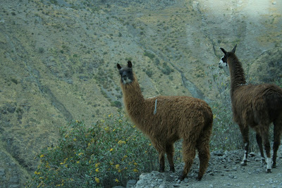
domestic llamas by the road
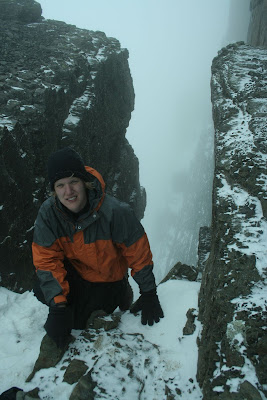
We reached our point of departure--which was probably around 12,000ft--around 900, packed some coca leaves to help with the altitude which was already apparent, and headed out. It was readily apparent that we were going into some pretty rough weather--snow, ice, and a biting wind made conditions pretty poor. For example, the camelbak hose of my friend Daniel froze about halfway up the mountain. The first step was scaling many feet of loose shale-like rock that surrounded the jagged peak.
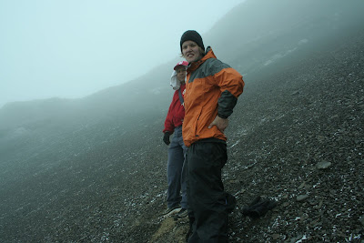
on the loose shale and in the clouds
We progressed onto hard rock/snow and into more of the storm.
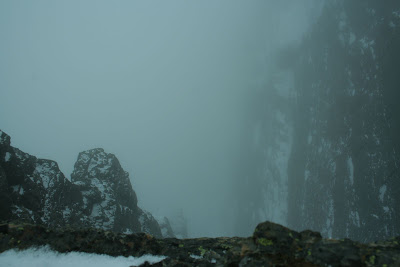
the final several hundred feet follow the edge of this abyss
After enduring the storm inside the clouds for about 2.5 hours we made it to the top, we things were so bad I couldn´t keep my camera lens clear for more than a few seconds at a time.
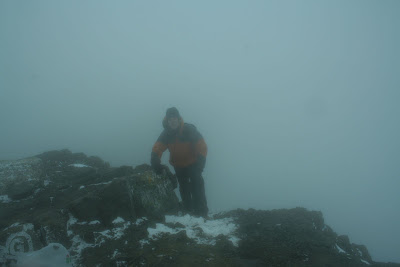
on the peak
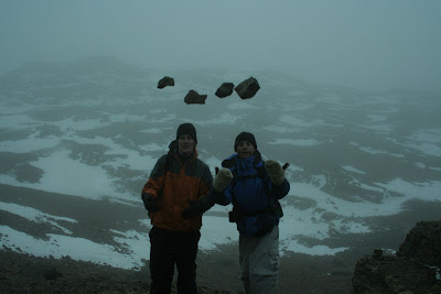
There are bizarre fossils of what Grover told us were worms and, if I translated correctly, crustaceans, on the peak--remains of an ancient sea that once covered all of Bolivia (see below).
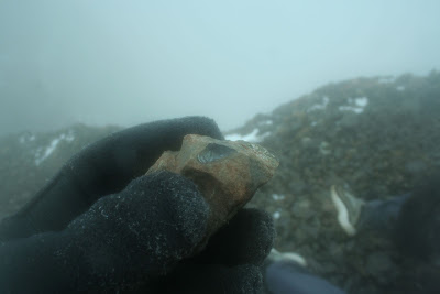
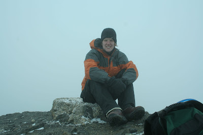
on top
posing below the peak now, the top is far above in the clouds
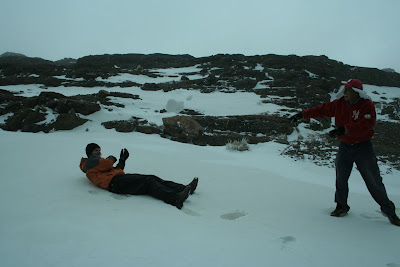
our guide wouldn´t let me sleep on the ice sheets
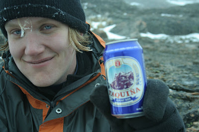
A bit lower when we could take decent photos, we posed with a can of Taquiña, the local beer, which bears the peak of Tunari on its label. Also evident is the sheet of ice around my exposed hair.
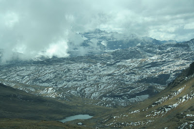
After about an hour of ski-ing/sliding/controlled falling down the backside of Tunari, we came out below the clouds and spotted this mountain in the distance. It was more or less clear of clouds, and we wanted to see the view of Cochabamba, so we decided to head over.
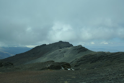
the most distant peak was our objective
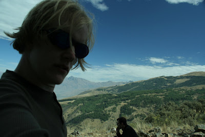
the scenery was like photos I´ve seen of Nepal--they call Bolivia the Nepal of the Andes for good reason

a little bit closer, we followed this ridge over to what we called machito tunari
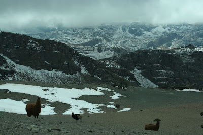
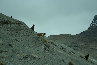
we encountered a herd of wild llamas on these ridiculously high slopes
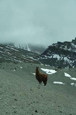
she was my favorite, and the most photogenic
We made it to this next peak after about 3 more hours of high-altitude scrambling--by this time the height was started to really sap our energy and it made it hard to keep up the pace we had set earlier (then out of necessity so we didn´t freeze!)
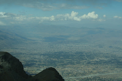
the vast expanse of the cochabamba valley--if you follow the picture, blow it up, and squint, you can barely make out the gigantic cristo towering over downtown--we were high...
and another a bit more to the right
Going back was hard. The detour to the other mountain cross several deep ravine/valleys, so we had to scale the same several hundred feet multiple times along the way.
the wild llamas wondering what the hell we were doing--on the right you can see the ridge leading up to clouds and the invisible peak of tunari
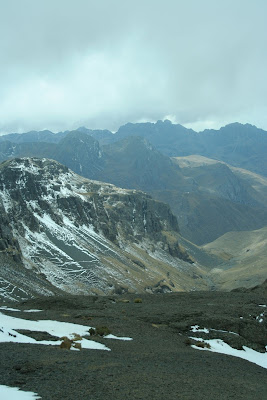
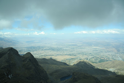
From the slope that would eventually take us to our landrover... Seriously, like Nepal
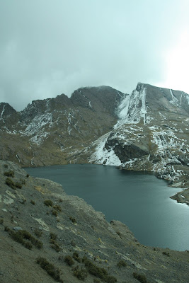
a laguna
And we made it back to the truck around 5pm--leaving a tour hour car ride to Cochabamba across the same crazy mountain road, pizza and taquiña, the final of copa america, and an early bed at 9pm.
Hacia harto frio.
nearing the top
Another student, Daniel, and I left Cochabamba around 630 in the morning along with our guide, Grover, and drove up onto the altiplano north of Cochabamba. The trip took about 2 hours due to the conditions of a narrow mountain pass that we followed, but the scenery was beautiful and we were able to see many campesino pueblos (some people of which Grover knew personally).
domestic llamas by the road
We reached our point of departure--which was probably around 12,000ft--around 900, packed some coca leaves to help with the altitude which was already apparent, and headed out. It was readily apparent that we were going into some pretty rough weather--snow, ice, and a biting wind made conditions pretty poor. For example, the camelbak hose of my friend Daniel froze about halfway up the mountain. The first step was scaling many feet of loose shale-like rock that surrounded the jagged peak.
on the loose shale and in the clouds
We progressed onto hard rock/snow and into more of the storm.
the final several hundred feet follow the edge of this abyss
After enduring the storm inside the clouds for about 2.5 hours we made it to the top, we things were so bad I couldn´t keep my camera lens clear for more than a few seconds at a time.
on the peak
There are bizarre fossils of what Grover told us were worms and, if I translated correctly, crustaceans, on the peak--remains of an ancient sea that once covered all of Bolivia (see below).
on top
posing below the peak now, the top is far above in the clouds
our guide wouldn´t let me sleep on the ice sheets
A bit lower when we could take decent photos, we posed with a can of Taquiña, the local beer, which bears the peak of Tunari on its label. Also evident is the sheet of ice around my exposed hair.
After about an hour of ski-ing/sliding/controlled falling down the backside of Tunari, we came out below the clouds and spotted this mountain in the distance. It was more or less clear of clouds, and we wanted to see the view of Cochabamba, so we decided to head over.
the most distant peak was our objective
the scenery was like photos I´ve seen of Nepal--they call Bolivia the Nepal of the Andes for good reason
a little bit closer, we followed this ridge over to what we called machito tunari
we encountered a herd of wild llamas on these ridiculously high slopes
she was my favorite, and the most photogenic
We made it to this next peak after about 3 more hours of high-altitude scrambling--by this time the height was started to really sap our energy and it made it hard to keep up the pace we had set earlier (then out of necessity so we didn´t freeze!)
the vast expanse of the cochabamba valley--if you follow the picture, blow it up, and squint, you can barely make out the gigantic cristo towering over downtown--we were high...
and another a bit more to the right
Going back was hard. The detour to the other mountain cross several deep ravine/valleys, so we had to scale the same several hundred feet multiple times along the way.
the wild llamas wondering what the hell we were doing--on the right you can see the ridge leading up to clouds and the invisible peak of tunari
From the slope that would eventually take us to our landrover... Seriously, like Nepal
a laguna
And we made it back to the truck around 5pm--leaving a tour hour car ride to Cochabamba across the same crazy mountain road, pizza and taquiña, the final of copa america, and an early bed at 9pm.
Hacia harto frio.
Wednesday, July 11, 2007
El Parque Nacional Tunari, Cochabamba, Bolivia
during lunch
This past weekend, myself and 3 others went to part of Parque Nacional Tunari, directly north of Cochabamba. We started out early in the morning and hiked up to the tree line, which took about 7 hours to get to and a bit of route finding. The hike itself was more or less straight uphill, but afforded some amazing vistas of Cochabamba and the surrounding mountains as well as a look into certain maneras of the people in the nearby hills.
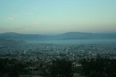
Cochabamba in the morning, just as we started
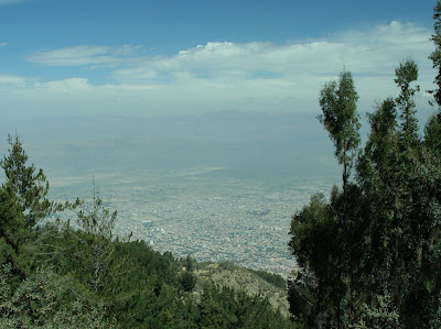
another photo, about 3/4 up the mountain
During the hike, we ran into several campesinos who were living on the hillside. Particularly memorable was a woman who we asked as to where we might find water (which was a problem for though lagunas are listed on the map, they turned out to be much further than we had thought). When she responded we realized she spoke only Quechua, one of the native tongues--but she did help get us back on the trail. I took the following shot of her tending to a herd of sheep after we had gotten a ways further up the mountainside. Our elevation relative to Coch is also apparent in this photo.

The rest of the day was uneventful, and my boots kept my toes from getting banged up into the toebox on the way back down--a welcome change from the grand canyon. It was a 12 hour day hike, but a lot of fun.
Next sunday, myself and a fellow student from Colorado are going to attempt to summit Cerro Tunari. The highest peak in the this Cordillera at 16,700 feet. We´ll be taking a local guide and it should be really great--especially because there is now snow dusting the peak due to a freak snowstorm that happened in the higher altitudes of Bolivia yesterday. I am prepared with long underwear, a waterproof outershell, and boots made from hiking in winter in the mountains, among other things--so it should just be a challenging high altitude summit. It takes about 4 hours up, and 2 back down. I am excited to share those photos...
Sunday, July 1, 2007
The Salar de Uyuni, Uyuni, Bolivia
We headed out around 1030 in a landrover with a guide, a japanese man, a french woman and her mexican husband (they spoke french, spanish, and english), and another french woman who was from southern france and a riot. The couple had been touring the world for over a year, and were now finishing up with 3 months left to ascend from the tip of Argentina to Mexico where they planned to start a biofarm. The lone french woman had come to South America to follow the steps of her hero Che Guevera--a trip which would culminate at his place of death in Bolivia upon the celebration of its anniversary. They were great partners for the trip, and it was fun to converse with French being translated into Spanish and vice versa.
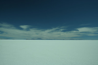
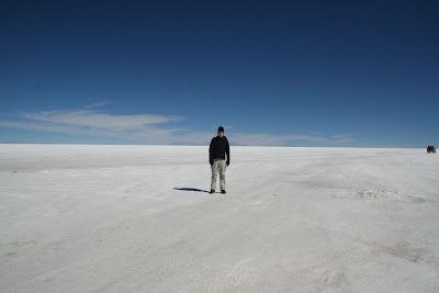
The Salar, recently named a wonder of the world by the Times UK, is a 4024 square mile expanse of salt--making it the largest salt flat in the world. At 3650m, or 12000 feet, it´s probably the highest too. There are tours of 4+ days offered of the flats, but since we were on a limited schedule we elected for just a 1 day excursion. Volcanoes, colored lakes, and bizarre rock formations scatter the corners of the flats--called Salvador Dali´s desert by some--and are accessible on longer tours. Going there in the winter is also quite frigid, with temperatures plumetting far below 0 at night and not getting much better due to wind in the daytime.
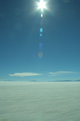
My polarizing filter and a quick shutter helped control the blast of sunlight that were the salt flats.
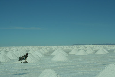
Indigenous locals shovel and process the salt for human consumption--exporting nearly 25000 tons a year from the flats. The salt is scooped into piles, and the piles are scooped into trucks.
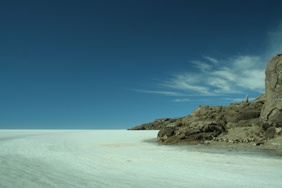
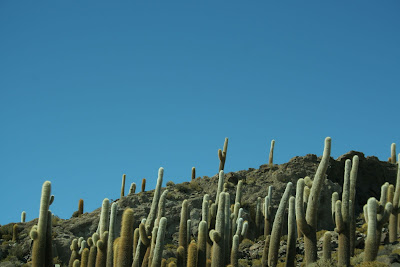
About halfway through the day, after driving at 65mph+ through the flats, we stopped at an "island" in the interior of the Salar for lunch. Bizarre cacti grow there, reminiscent of southern arizona--but in a sea of salt.
At this point, I was talking with the french couple about what might be wrong with me and they told me they were having trouble with altitude sickness themselves. They were taking a "natural" red and white pill which solved their problems. After being offered one, I eagerly took it as I was starving for calories to keep myself warm and within twenty minutes my problems were similarly solved. Having lunch was nice.
able to move around again!
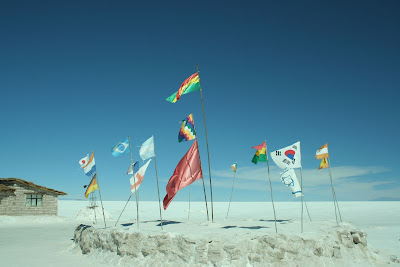
an arrangement of flags outside a hotel made of salt on the salar
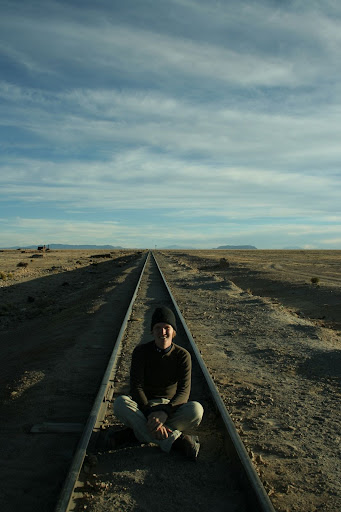
After a few more hours, we drove back off the Salar and into Uyuni. First stopping by a desolate gathering of more than a dozen rusted train engines. Our guide explained to us that they were leftovers from the mining boom which saw the forced exploitation of Bolivia´s vast mineral resources. The mining companies simply had left them to rust next to the track that goes from Uyuni to Chile and Argentina. Another example of the abuses and exploitations Bolivians have suffered throughout history.
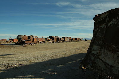
just a glimpse of the spread of rust

traveling
We got back into town around 630, and had wine and pizza with the french folk until our train left at 9pm for Oruru, connected in Oruru for Cochabamba at 6am, and got into town around noon today. It was an experiment in sleep deprivation, but certainly worth it. I´d like to go back again sometime and do a full 4 day trip, it has to be one of the most surreal environments I´ve ever encountered. Hopefully I´ll meet up again with the couple when they make their way through Cochabamba on their way north.
The Salar, recently named a wonder of the world by the Times UK, is a 4024 square mile expanse of salt--making it the largest salt flat in the world. At 3650m, or 12000 feet, it´s probably the highest too. There are tours of 4+ days offered of the flats, but since we were on a limited schedule we elected for just a 1 day excursion. Volcanoes, colored lakes, and bizarre rock formations scatter the corners of the flats--called Salvador Dali´s desert by some--and are accessible on longer tours. Going there in the winter is also quite frigid, with temperatures plumetting far below 0 at night and not getting much better due to wind in the daytime.
My polarizing filter and a quick shutter helped control the blast of sunlight that were the salt flats.
Indigenous locals shovel and process the salt for human consumption--exporting nearly 25000 tons a year from the flats. The salt is scooped into piles, and the piles are scooped into trucks.
About halfway through the day, after driving at 65mph+ through the flats, we stopped at an "island" in the interior of the Salar for lunch. Bizarre cacti grow there, reminiscent of southern arizona--but in a sea of salt.
At this point, I was talking with the french couple about what might be wrong with me and they told me they were having trouble with altitude sickness themselves. They were taking a "natural" red and white pill which solved their problems. After being offered one, I eagerly took it as I was starving for calories to keep myself warm and within twenty minutes my problems were similarly solved. Having lunch was nice.
able to move around again!
an arrangement of flags outside a hotel made of salt on the salar
After a few more hours, we drove back off the Salar and into Uyuni. First stopping by a desolate gathering of more than a dozen rusted train engines. Our guide explained to us that they were leftovers from the mining boom which saw the forced exploitation of Bolivia´s vast mineral resources. The mining companies simply had left them to rust next to the track that goes from Uyuni to Chile and Argentina. Another example of the abuses and exploitations Bolivians have suffered throughout history.
just a glimpse of the spread of rust
traveling
We got back into town around 630, and had wine and pizza with the french folk until our train left at 9pm for Oruru, connected in Oruru for Cochabamba at 6am, and got into town around noon today. It was an experiment in sleep deprivation, but certainly worth it. I´d like to go back again sometime and do a full 4 day trip, it has to be one of the most surreal environments I´ve ever encountered. Hopefully I´ll meet up again with the couple when they make their way through Cochabamba on their way north.
Subscribe to:
Posts (Atom)